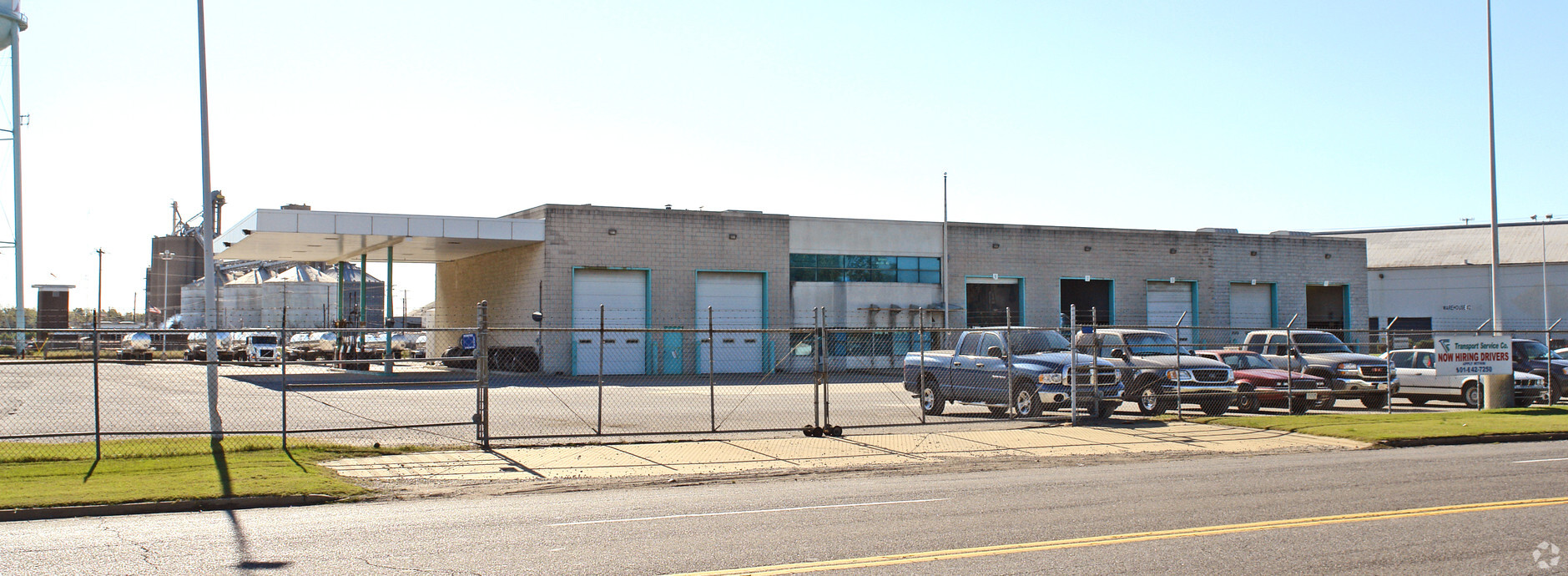
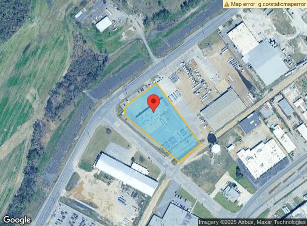
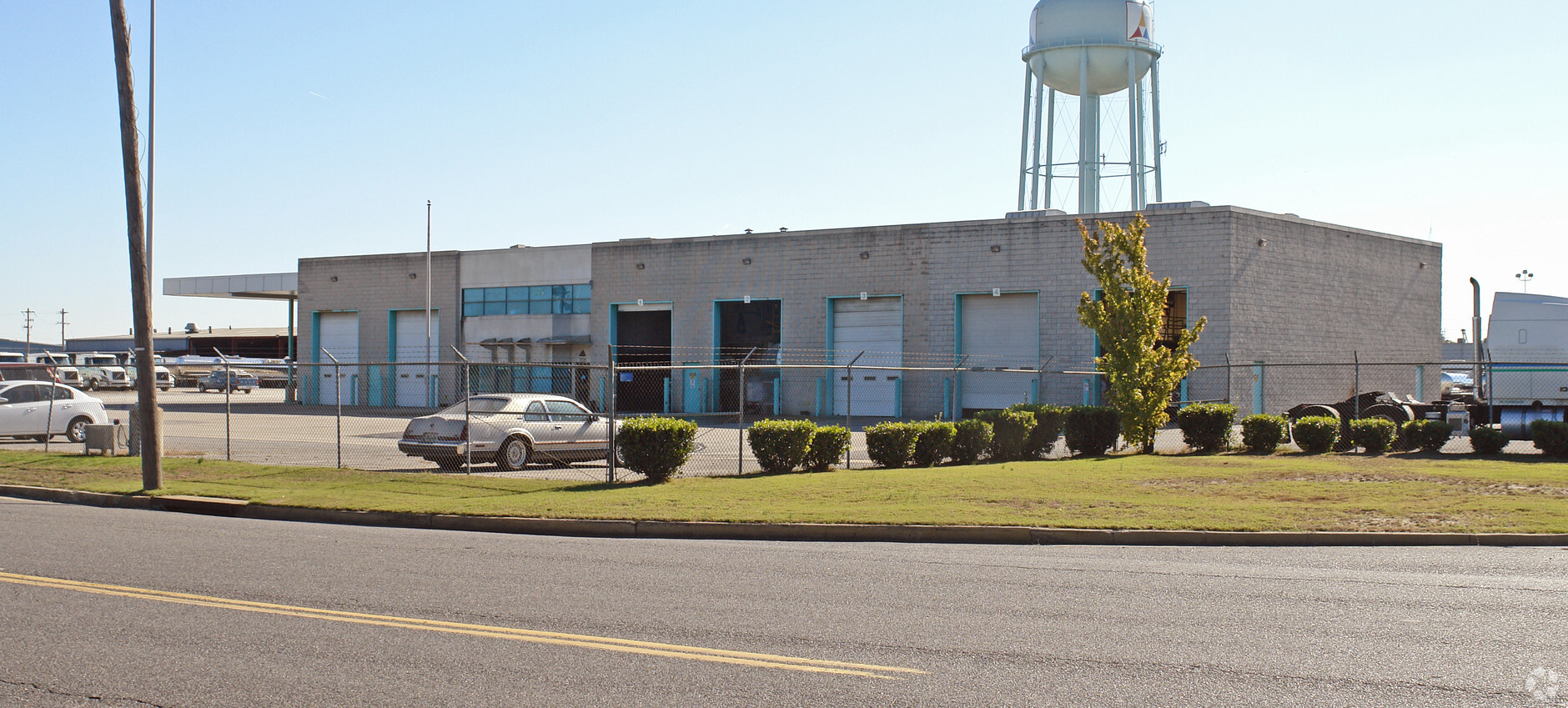
Property Record
1725 Harbor Ave, Memphis, TN 38113
NEARBY LISTINGS FOR SALE OR LEASE
Property Detail
1725 Harbor Ave
Memphis, TN-MS-AR
Memphis & Shelby County Port Commissions
05-0110-0-0001
SOME INFO KEYED FROM LEGAL DESCRIPTION, BUT COMPLETE LEGAL NOT CAPTURED
Autorepair
Shelby
X
Tennessee
05035C0475E
154
0
3.08 AC
2024
Southwest
980200
Memphis
11,900 SF
DEMOGRAPHICS near 1725 Harbor Ave
1 Mile
3 Mile
5 Mile
2024 Total Population
0
8,340
66,928
2029 Population
0
8,626
67,437
Pop Growth 2024-2029
0.00%
+ 3.43%
+ 0.76%
Average Age
0
42
39
2024 Total Households
0
3,479
28,930
HH Growth 2024-2029
0.00%
+ 3.39%
+ 0.72%
Median Household Inc
$0
$23,254
$32,914
Avg Household Size
.00
2.30
2.20
2024 Avg HH Vehicles
.00
1.00
1.00
Median Home Value
$0
$70,242
$72,347
Median Year Built
0
1958
1964
Nearby Places
- Restaurants
- Banks
- Shops
- Fitness
- Groceries
PUBLIC TRANSPORTATION
COMMUTER RAIL
Central Station (Riverfront Loop - Memphis Area Transit Authority Trolley (MataTrolley))
DRIVE
WALK
Distance
Central Station (Riverfront Loop - Memphis Area Transit Authority Trolley (MataTrolley))
12 min
4.5 mi
AIRPORT
Memphis International
DRIVE
WALK
Distance
Memphis International
23 min
11.8 mi
Freight Ports
Port of Shreveport
DRIVE
WALK
Distance
Port of Shreveport
406 min
371.2 mi
Nearby Properties
Address
Land Use
TOTAL SIZE
Lot Size
Zoning
Address
Land Use
TOTAL SIZE
Lot Size
Zoning
438,763 SF
64.67 AC
IH
Address
Land Use
TOTAL SIZE
Lot Size
Zoning
342,931 SF
20.87 AC
IH
Address
Land Use
TOTAL SIZE
Lot Size
Zoning
451,501 SF
21.78 AC
IH
Address
Land Use
TOTAL SIZE
Lot Size
Zoning
222,777 SF
119.84 AC
IH
Address
Land Use
TOTAL SIZE
Lot Size
Zoning
381.30 AC
R-15
Address
Land Use
TOTAL SIZE
Lot Size
Zoning
54,000 SF
293.13 AC
IH
Address
Land Use
TOTAL SIZE
Lot Size
Zoning
4,000 SF
12.32 AC
IH
Address
Land Use
TOTAL SIZE
Lot Size
Zoning
62,285 SF
6.66 AC
RU-3
Address
Land Use
TOTAL SIZE
Lot Size
Zoning
66,720 SF
7.19 AC
IH
Address
Land Use
TOTAL SIZE
Lot Size
Zoning
419.63 AC
CA
Address
Land Use
TOTAL SIZE
Lot Size
Zoning
33,260 SF
27.33 AC
IH
Address
Land Use
TOTAL SIZE
Lot Size
Zoning
249,882 SF
13.11 AC
IH
Address
Land Use
TOTAL SIZE
Lot Size
Zoning
238,010 SF
16.58 AC
IH
Address
Land Use
TOTAL SIZE
Lot Size
Zoning
279,743 SF
11.90 AC
EMP
Address
Land Use
TOTAL SIZE
Lot Size
Zoning
65.47 AC
IH
Address
Land Use
TOTAL SIZE
Lot Size
Zoning
235,562 SF
22.42 AC
CMU-3
Address
Land Use
TOTAL SIZE
Lot Size
Zoning
161,402 SF
8.07 AC
IH
Address
Land Use
TOTAL SIZE
Lot Size
Zoning
225,019 SF
9.48 AC
IH
Address
Land Use
TOTAL SIZE
Lot Size
Zoning
90,310 SF
3.79 AC
IH
Address
Land Use
TOTAL SIZE
Lot Size
Zoning
232,342 SF
6.02 AC
EMP
Address
Land Use
TOTAL SIZE
Lot Size
Zoning
316,830 SF
23.55 AC
EMP
Address
Land Use
TOTAL SIZE
Lot Size
Zoning
43,230 SF
4.06 AC
R-R
Address
Land Use
TOTAL SIZE
Lot Size
Zoning
406.55 AC
R-6
Address
Land Use
TOTAL SIZE
Lot Size
Zoning
574,932 SF
24.22 AC
IH
Address
Land Use
TOTAL SIZE
Lot Size
Zoning
40,884 SF
4.11 AC
RU-3
Address
Land Use
TOTAL SIZE
Lot Size
Zoning
23,650 SF
42.45 AC
IH
Address
Land Use
TOTAL SIZE
Lot Size
Zoning
33.90 AC
IH
Address
Land Use
TOTAL SIZE
Lot Size
Zoning
29,010 SF
49.53 AC
CA
Address
Land Use
TOTAL SIZE
Lot Size
Zoning
32,320 SF
14.10 AC
IH
Address
Land Use
TOTAL SIZE
Lot Size
Zoning
64,944 SF
20.06 AC
IH
The World's #1 Commercial Real Estate Marketplace
Connect with us
© 2025 CoStar Group
The information above has been obtained from sources believed reliable. While we do not doubt its accuracy we have not verified it and make no guarantee, warranty or representation about it. It is your responsibility to independently confirm its accuracy and completeness. Any projections, opinions, assumptions, or estimates used are for example only and do not represent the current or future performance of the property. The value of this transaction to you depends on tax and other factors which should be evaluated by your tax, financial, and legal advisors. You and your advisors should conduct a careful, independent investigation of the property to determine to your satisfaction the suitability of the property for your needs.